Find Your Neighborhood
Find the Boulder and Front Range neighborhoods that feel like you. Choose what matters, see your matches on the map, and compare home prices and days on market across Boulder, Longmont, Loveland, Fort Collins & The Front Range.
Find My Fit
Select your preferences below. This is a starting shortlist — it is not a ranking. We recommend verifying a specific address and actual commute with your agent or on a site visit. No numerical walkability or commute scores are implied.
Get a feel for the market
CAR Boulder Report (LBAR)
The official monthly market data for Boulder County, provided through the Longmont Board of REALTORS® chapter of CAR.
Download PDF →Take a look around
Choose a community to read its guide, then open its outline in the map explorer above.
Solid outlines show municipal boundaries. Dashed outlines show approximate neighborhood study areas; they are not parcel surveys. Some study areas overlap.
Boulder Municipal boundary · Explore map
Explore the City of Boulder within its municipal boundary. Individual neighborhoods and unincorporated foothill communities have different extents.
Explore Boulder guides →Longmont Community guide & neighborhoods
Read the Longmont community guide →
Explore Downtown, Southwest, Northwest, Northeast and Southeast Longmont in the neighborhood rows below.
Loveland Community guide & neighborhoods
Read the Loveland community guide →
Choose Loveland in the map above to explore its regional setting.
Fort Collins Community guide & neighborhoods
Choose Fort Collins in the map above to explore its regional setting, landmarks and available market figures.
Additional neighborhood guides are not yet available here.
Lyons Community guide & neighborhoods
Read the Lyons community guide →
The Downtown Lyons and Lyons mountain-corridor rows below retain their existing study areas.
Golden Walkable downtown · School of Mines · Coors Brewery
Explore Golden with an emphasis on its walkable downtown core, where shops, cafes and restaurants cluster along Washington Avenue. Nearby Colorado School of Mines brings a university presence to town, while the landmark Coors Brewery is a distinctive part of Golden’s identity. Homes near the center offer a convenient base for downtown outings; walking distances and routes vary by address.
Map © OpenStreetMap contributors · Approximate downtown location
Open a larger map ↗Berthoud Community guide · New construction
Explore Berthoud through its community guide, or see its ZIP code boundary on the map.
Read the Berthoud community guide →Firestone Value per square foot · New construction · Denver access
Put Firestone on your shortlist if getting more home for your budget is a priority. Buyers seeking a low price per square foot can compare its newer homes and new-construction communities with options across the Boulder–Denver region. Explore developments such as Barefoot Lakes and Cordovan for modern layouts and builder choices. Convenient access to I-25 provides a direct route south toward Denver, making Firestone worth considering for commuters; travel times depend on traffic and your destination. Compare recent sales using the same finished-square-footage basis to confirm value, and review builder incentives, property taxes and HOA costs.
Map © OpenStreetMap contributors · Approximate area center
Open a larger map ↗Firestone community guide → · Residential development projects →
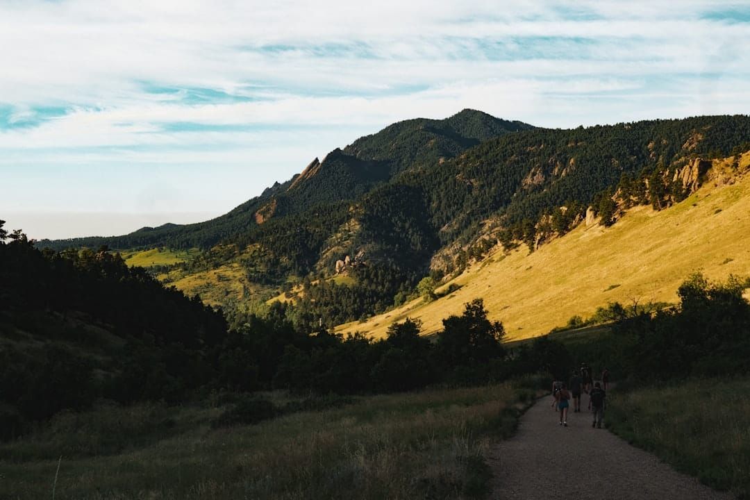
North Boulder Explore photos & map
Explore North Boulder and the communities to its north for easy access to nearby trails, mountain-view opportunities, and lake-oriented living. Consider Lake of the Pines, homes around Lake Valley Golf Club, and Waterstone near Sixmile Reservoir for settings with potential lake or water views and access. Trail connections, mountain and water views, and lake-use rights vary by property; confirm HOA membership, permitted activities and access rights for each home.
Map © OpenStreetMap contributors · Approximate location
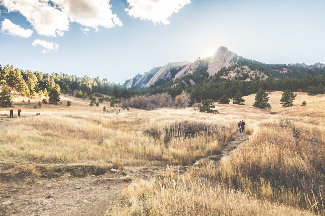
Open a larger map ↗South Boulder Explore photos & map
Explore South Boulder, including Table Mesa, as one combined search area. Picture the route from each home to the parks, trails, shops, and everyday stops you use most.
Map © OpenStreetMap contributors · Approximate location
Open a larger map ↗Gunbarrel Explore photos & map
Look northeast of central Boulder and compare housing options, amenities, and your actual commute.
Map © OpenStreetMap contributors · Approximate location
Open a larger map ↗Newlands Explore map & local guide
Explore the blocks around North Boulder Park, west of Broadway. Original bungalows and rebuilt homes can be very different purchases; compare the home’s condition, lot, and scope for changes.
Map © OpenStreetMap contributors · Approximate area center, not a boundary
Mapleton Hill Explore map & local guide
Explore the historic neighborhood northwest of downtown along Mapleton Avenue. If you hope to change the home, check the specific property’s historic status and review requirements before planning work.
Map © OpenStreetMap contributors · Approximate area center, not a boundary
Wonderland Lake/Hills Explore map & local guide
Explore Wonderland Lake and Wonderland Hills together, with residential streets west of Broadway, access to the lake and surrounding open-space trails, and homes extending south toward Linden Avenue. Detached houses, townhomes and patio homes offer different settings; views, trail access and HOA arrangements vary by property.
Map © OpenStreetMap contributors · Approximate area center, not a boundary
Niwot Explore map
Explore the village center and surrounding neighborhoods between Boulder and Longmont.
Map © OpenStreetMap contributors · Approximate location
Open a larger map ↗Downtown Longmont Within 10 blocks of Main Street · Explore map
Explore Downtown Longmont neighborhoods within 10 blocks of Main Street, focusing on the downtown street grid around Roosevelt Park and the 3rd–9th Avenue area shown here. Outlying Longmont communities are outside this search area.
Start with a specific address and check its distance to Main Street and your actual walking route to shops, restaurants, and everyday stops.
Map © OpenStreetMap contributors · Downtown orientation map; the pin and map edges do not mark a precise 10-block boundary. Verify each address.
Open a larger map ↗Southwest Longmont Often newer-built homes · Explore map
Explore Southwest Longmont, including the communities of Sommerset, Clover Meadows, and Dry Creek. Homes here are often newer-built, offering another option alongside Downtown Longmont’s established neighborhoods. Compare each home’s year built, condition, layout, and nearby parks and paths.
Use the area around Clover Basin Drive, Airport Road, and the nearby neighborhood parks as a starting point. Check the specific property’s HOA, maintenance needs, and routes to your everyday destinations.
Map © OpenStreetMap contributors · Approximate area orientation, not community boundaries
Northwest Longmont McIntosh Lake · Views & paddling · Explore map
Explore Northwest Longmont with an emphasis on homes around McIntosh Lake, Dawson Park, and Flanders Park. This lake-centered setting offers opportunities for beautiful water and mountain views; the outlook varies by home, so check the specific property. Enjoy nearby trails, kayaking, paddleboarding, and other permitted non-motorized lake recreation.
McIntosh Lake permits carry-on, non-motorized craft, including kayaks and paddleboards, launched only at designated ramps. Swimming is prohibited. Bring a personal flotation device for every person, and check current lake conditions and City rules before heading out.
Map © OpenStreetMap contributors · Approximate lake-area orientation, not neighborhood boundaries
Lake activities & current rules ↗ · Explore Longmont guides → · Open a larger map ↗
Northeast Longmont Ute Creek Golf Course · Value & I-25 access · Explore map
Explore Northeast Longmont with an emphasis on the neighborhoods around Ute Creek Golf Course. This is an area to consider for strong value for money and the potential for a lower price per square foot. Compare recent sales of similar homes to confirm value, accounting for condition, finished space, and location. Access east toward I-25 is another draw; test your route at your usual travel time.
Start around Ute Creek Golf Course, East 17th Avenue, East 21st Avenue, and Pace Street. Compare golf-course-adjacent homes with nearby streets, and consider routes via Highway 66 toward I-25.
Map © OpenStreetMap contributors · Approximate area orientation, not neighborhood boundaries
Explore Ute Creek Golf Course ↗ · Explore Longmont guides → · Open a larger map ↗
Southeast Longmont Fox Hill · Golf-course views & local shopping · Explore map
Explore Southeast Longmont with an emphasis on homes around The Fox Hill Club golf course. Look for premium-lot opportunities with beautiful golf-course and mountain views, which vary by property and orientation. Convenient access to Costco Wholesale and the shops and restaurants along Ken Pratt Boulevard adds to the area’s appeal.
Compare the lot’s setting, privacy, outdoor space, and actual views from the home. The Fox Hill Club is a private golf club; check membership and access separately from a home purchase. Try your everyday route to Costco at 205 East Ken Pratt Boulevard and the surrounding shopping and dining destinations.
Map © OpenStreetMap contributors · Approximate area orientation, not neighborhood boundaries
Explore The Fox Hill Club ↗ · Longmont Costco ↗ · Open a larger map ↗
Downtown Lyons Main Street · Small-town community · Creekside recreation
Discover Downtown Lyons, a small town center with a close-knit community feel and a lively collection of Main Street shops and restaurants within walking reach of nearby homes. Life here revolves around the St. Vrain creeks flowing down from the Rocky Mountains: tubing, kayaking, and other seasonal water recreation complement walking, biking, and hiking around the town’s parks and connected trails. Explore the North St. Vrain at LaVern Johnson Park, then enjoy Bohn Park and the wider creekside path network.
Spend a morning browsing Main Street, take a creekside walk or bike ride, or explore Bohn Park and its trail connections. Tubing and kayaking depend on seasonal flows and current conditions; check the Town’s recreation guidance before entering the water. Verify walking routes and creek access from each home.
Map © OpenStreetMap contributors · Approximate downtown orientation, not a neighborhood boundary
Read the Lyons guide → · Explore Bohn Park ↗ · Creek recreation information ↗ · Open a larger map ↗
Lyons US 36 mountain corridor · Pinewood Springs & Big Elk Meadows
Explore the broader Lyons mountain area along US 36, a key gateway from Lyons toward Estes Park and Rocky Mountain National Park. This option focuses on Pinewood Springs and Big Elk Meadows, with homes in mountain settings reached from the highway and connecting roads. Pinewood Springs offers its own fire station, a community water district, and the Colorado Cherry Company. Big Elk Meadows offers a tucked-away setting between Lyons and Estes Park, with cabins, mountain homes, and shared recreation amenities.
Pinewood Springs
A mountain community along US 36 with a local fire station and water supplied within the Pinewood Springs Water District. Stop at the Colorado Cherry Company, a local favorite for pie, coffee, and baked treats. Confirm each property’s water service, current district notices, and road access.
Big Elk Meadows
Tucked into the forested mountains between Lyons and Estes Park, Big Elk Meadows combines a retreat-like setting with a mix of cabins and larger mountain homes. Residents share lakes and recreation facilities, and nearby national-forest routes offer opportunities to explore outdoors. Both year-round and seasonal homeowners make up the community. Review association fees, amenity rules, utilities, and winter access for any property you consider.
Big Elk Meadows overview paraphrased from Signature Home Team’s community guide ↗.
Map © OpenStreetMap contributors · Pin marks approximate Pinewood Springs orientation within the broader corridor; not a neighborhood boundary
Colorado Cherry Company ↗ · Local fire district ↗ · Water district reports ↗ · Open a larger map ↗
Estes Park Downtown dining · Mountain views · National park gateway
Explore Estes Park for its lively downtown shops, galleries, and restaurants, dramatic mountain scenery, and outdoor recreation. Stroll along Elkhorn Avenue and the Downtown Riverwalk, then head out for hiking, fishing, climbing, or seasonal snowshoeing. With Rocky Mountain National Park at the town’s western edge, Estes Park is a natural base for mountain adventures. Look for homes with sweeping views, and compare the actual outlook and access from each property.
Picture a day that starts with coffee downtown and ends with a mountain view. Compare homes near the shops and Riverwalk with quieter settings farther out, and test everyday driving routes during busy visitor seasons. Check current national park entry requirements and road conditions when planning outings.
Map © OpenStreetMap contributors · Approximate town orientation, not neighborhood boundaries
Explore the Downtown Riverwalk ↗ · Rocky Mountain National Park ↗ · Open a larger map ↗
Superior Schools · Mountain views · Boulder & Denver access
Explore the town of Superior for its highly rated local school options, proximity to Boulder, mountain-view opportunities, and convenient access toward Denver along US 36. Superior Elementary is one example of a local school with strong published performance results. Confirm the assigned schools for each address and enrollment year, and compare the programs that matter to you. Views and travel times vary by property.
Superior sits along the Boulder–Denver US 36 corridor. Explore the drive to your everyday destinations and regional transit from the US 36 & McCaslin Park-n-Ride. Visit each home to assess its mountain outlook and test your commute at the times you normally travel.
Map © OpenStreetMap contributors · Approximate town orientation, not school attendance boundaries
Superior Elementary performance ↗ · Transit & commuting options ↗ · Open a larger map ↗
Louisville Value opportunities · Denver & mountain access
Explore Louisville for potential value for money, a location closer to Denver than Boulder, and convenient routes west toward the foothills and mountains. Compare the space, condition, and features your budget buys using recent comparable sales. Access to the US 36 corridor makes Louisville worth considering when balancing Denver trips with mountain outings.
Compare homes across Louisville’s neighborhoods, then test your route toward Denver via US 36 and west toward Boulder and mountain destinations. Travel times depend on the specific address, traffic, and your destination.
Map © OpenStreetMap contributors · Approximate city orientation, not neighborhood boundaries
Explore Louisville city information ↗ · Compare homes with True North Boulder → · Open a larger map ↗
Lafayette Historic Old Town · Sunday market · Welcoming atmosphere
Discover Lafayette’s welcoming atmosphere and historic Old Town district along Public Road, where local shops, restaurants, and community gatherings bring the streets to life. The farmers market takes place every Sunday from May through October, 9 a.m.–1 p.m., on Public Road between Cleveland and Geneseo streets. Fortune ranked Lafayette #7 on its 2024 Best Places to Live for Families list after evaluating more than 2,000 cities nationwide. With potential value for money, proximity to Denver, and routes west toward the mountains, Lafayette offers plenty to explore.
Farmers market schedule ↗ · City awards & Fortune recognition ↗ · Fortune’s 2024 Lafayette profile ↗
Try the routes that fit your routine: US 287 toward Broomfield and Denver connections, or west along Arapahoe Road toward Boulder and mountain destinations. Check actual travel times from each home, including busy commuting and weekend periods.
Map © OpenStreetMap contributors · Approximate city orientation, not neighborhood boundaries
Explore Lafayette city information ↗ · Compare homes with True North Boulder → · Open a larger map ↗
Broomfield Shopping · Children’s Hospital North Campus · US 36
Explore Broomfield for convenient access to shopping, dining, and entertainment at FlatIron Crossing mall and nearby Westminster Promenade. Its location along the US 36 corridor connects you toward Boulder and Denver, while Children’s Hospital Colorado’s North Campus provides a nearby healthcare destination in northern Broomfield. Compare each neighborhood’s location to the places you visit most.
Broomfield covers a broad area. Test the drive from each home to FlatIron Crossing, Westminster Promenade, and Children’s Hospital Colorado’s North Campus at 469 State Highway 7, near I-25. Proximity and travel times vary by neighborhood and traffic.
Map © OpenStreetMap contributors · Approximate city orientation, not neighborhood boundaries
Explore FlatIron Crossing ↗ · Children’s Hospital North Campus ↗ · Open a larger map ↗
Pine Brook Hills Mountain residential community · Explore map
Picture a home among the pines in the foothills west of Boulder. Pine Brook Hills offers a mountain residential setting with primarily detached homes, wooded lots, and mountain or valley views depending on the property.
Plan for driving to everyday amenities and test your actual route. Before choosing a home, check winter road access, wildfire mitigation, insurance availability, water service, and septic arrangements.
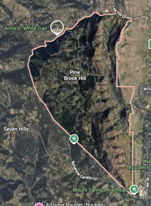
Map © OpenStreetMap contributors · Approximate community center, not a boundary
Chautauqua/University Hill Chautauqua trails · Near CU Boulder · Explore map & guide
Explore the combined Chautauqua and University Hill area, from the residential streets near Boulder Creek to Chautauqua Park and the homes south of Baseline Road. The Hill offers shops, restaurants and proximity to CU Boulder, while Chautauqua brings access to foothill trails and Flatirons scenery. Walking distances, street activity and views vary across this broader area.
Visit the specific block at different times to judge activity and noise, and check parking arrangements. If a property has tenants, review its leases and your intended move-in timing before making plans.
Map © OpenStreetMap contributors · Approximate neighborhood center, not a boundary
Central Boulder Downtown / Main Street walkable · Explore map
Start around downtown and Pearl Street when being able to walk to shops, restaurants, and everyday destinations is high on your list. Central Boulder is a broader area, so compare the actual route, crossings, and walking distance from each home.
This map focuses on downtown as an orientation point, not the full Central Boulder boundary. Visit your shortlisted blocks at different times and check parking and street activity.
Map © OpenStreetMap contributors · Downtown orientation point, not a neighborhood boundary
Nederland Mountain residential community · Explore map
Nederland brings mountain-town living together with downtown shops, cafes, and restaurants, surrounded by mountain scenery west of Boulder. Nearby Eldora offers convenient access to skiing, while local trails and the surrounding high country invite hiking and outdoor exploration. Mountain views and access to downtown vary by home, giving buyers a range of settings to explore.
Map © OpenStreetMap contributors · Approximate Nederland and Eldora area orientation, not neighborhood boundaries
Explore Boulder-area guides → · Explore Nederland shops and dining ↗ · Nederland trails and open spaces ↗ · Open a larger map ↗
Eldorado Canyon Mountain residential community · Explore map
Eldorado Canyon offers private homes in a dramatic canyon setting at the gateway to Eldorado Canyon State Park, southwest of Boulder. The Eldorado Springs community pairs distinctive homes and towering sandstone scenery with access to renowned rock climbing and scenic hiking in the neighboring park—an appealing setting for a mountain lifestyle centered on the outdoors.
Map © OpenStreetMap contributors · Approximate Eldorado Springs orientation point, not neighborhood or state park boundaries
Explore Boulder guides → · Explore Eldorado Canyon State Park ↗ · Eldorado Springs community plan ↗ · Open a larger map ↗
Sunshine Canyon Drive / Seven Hills Mountain residential community · Explore map
Sunshine Canyon Drive and Seven Hills offer a mountain residential setting in the foothills northwest of Boulder, with winding roads, wooded hillsides, and views that vary by home. This combined area pairs a quieter mountain setting with access down the canyon to Boulder and outdoor outings at nearby Bald Mountain Scenic Area.
Map © OpenStreetMap contributors · Approximate Seven Hills orientation point within the broader Sunshine Canyon search area, not neighborhood boundaries
Explore Boulder guides → · Bald Mountain trail map ↗ · Open a larger map ↗
Boulder Canyon / Sugarloaf Mountain residential community · Explore map
A scenic mountain corridor west of Boulder, Boulder Canyon follows Colorado 119 toward Nederland, with onward access to skiing at Eldora. Sugarloaf adds a mountain residential setting above the canyon, with wooded surroundings and views that vary by property. Explore this area for a mountain lifestyle connected to Boulder and high-country recreation.
Map © OpenStreetMap contributors · Approximate Sugarloaf orientation point within the broader Boulder Canyon corridor, not neighborhood boundaries
Explore Boulder guides → · Explore Boulder Canyon and Boulder Falls ↗ · Open a larger map ↗
Lee Hill / Lazy Acres Mountain residential setting · Explore map
Explore the Lee Hill corridor and Lazy Acres in the foothills northwest of Boulder. Use this combined area to begin a search for mountain residential living, then compare the terrain, access, and setting of individual homes.
Plan around your actual driving route and check winter access, road-maintenance responsibilities, wildfire mitigation, insurance availability, and the property’s water and wastewater systems.
Map © OpenStreetMap contributors · Approximate Lazy Acres orientation point within the broader Lee Hill search area, not a boundary
Explore Boulder guides → · Talk through a Lee Hill / Lazy Acres property → · Open a larger map ↗
Palo Park/Four Mile Creek Neighborhood parks & paths · Explore map
Explore Palo Park/Four Mile Creek in northeast Boulder, with residential streets, neighborhood parks, and nearby greenways and trails. Compare each home’s walking and biking connections, daily travel routes, and HOA responsibilities.
Map © OpenStreetMap contributors · Approximate neighborhood orientation point, not a boundary
Explore Boulder guides → · Talk through a Palo Park property → · Open a larger map ↗
Make the most of a neighborhood visit
Try your commute at the time you’ll actually travel. Walk to your everyday stops, explore the specific block, and compare two or three areas. Maps are a starting point; a visit fills in the details.
Talk through your shortlist with Daniel →