Lafayette neighborhoods
Open a neighborhood for a short local introduction and a link to find it on the map.
Anna’s Farm
Anna’s Farm brings detached houses, duplex condos and row townhomes together near Baseline Road and US 287. The playground sits at the northwest end of the neighborhood. On a first visit, start there and compare how the different housing types open onto the nearby sidewalks.
Explore Anna’s Farm →Autumn Meadows
Autumn Ridge Boulevard runs through Autumn Meadows in southern Lafayette. Whitetail Park is on the same boulevard, with ballfields, a basketball court and a biking trail. Cherrywood Drive and Cedarwood Circle give you two nearby residential streets to explore.
Explore Autumn Meadows →Avalon Meadows
Look for Avalon Meadows around Kohlor Drive and Keatons Way in southeastern Lafayette. These two street names are useful when narrowing a home search to this small subdivision.
Explore Avalon Meadows →Beacon Hill
Autumn Ash Park on Lucerne Drive is a good place to start a walk through Beacon Hill. Nearby Vetch Circle and Sedge Way lead into the residential blocks of this north Lafayette neighborhood.
Explore Beacon Hill →Blue Heron Estates
Blue Heron Circle and Columbine Circle wind through this subdivision in northwestern Lafayette. Start with the blocks east of North 95th Street when comparing locations on a map.
Explore Blue Heron Estates →Centaur Village
Zeus Drive, Athene Drive and Centaur Circle are some of the distinctive street names in Centaur Village. On the south side, Cottonwood Park has a paved path connecting to the Coal Creek Regional Trail.
Explore Centaur Village →Coal Creek Village
Cheyenne Drive and Cheyenne Court are two good landmarks for Coal Creek Village in southern Lafayette. The name also appears on several nearby subdivision filings that together make up the neighborhood.
Explore Coal Creek Village →Hearthwood
Milo Circle, Gooseberry Court and Barberry Circle are useful starting points for exploring Hearthwood. The neighborhood sits south of central Lafayette, with homes on a mix of short courts and looping streets.
Explore Hearthwood →Indian Peaks
Indian Peaks wraps around Lafayette’s municipal golf course. Streets that look close across a fairway can belong to different parts of the community. Use the master association’s sub-association directory to identify the right contact for a home, then use the city course map to orient yourself on the surrounding streets.
Explore Indian Peaks →Lafayette Park
Lafayette Park is a residential neighborhood in northern Lafayette. Lindenwood Park is the neighborhood park, while Bass Circle, Harrison Drive and Acadia Avenue are useful streets for exploring the surrounding homes.
Explore Lafayette Park →Old Town Lafayette
East Simpson Street is a useful introduction to Lafayette’s oldest residential blocks. The Lafayette History Museum occupies a former miner’s home that was moved here after a mine closed. Start with the museum, then walk toward Public Road to see where the houses give way to shops and restaurants.
Explore Old Town Lafayette →Silo
On Arapahoe Road west of US 287, Silo was planned around energy-conscious home design. The development team describes passive solar design alongside technologies such as solar panels and geothermal systems. When touring, ask for the equipment list for the specific home and the current phase plan for the next block.
Explore Silo →Silver Creek
Silver Creek’s blocks include cottages, detached houses, townhomes and condo lofts. West Starline Avenue makes a useful first stop. Silver Creek Park has a farm-themed playground, a zip line and a sledding hill, and the builder’s street plan shows how the housing types are distributed around the park.
Explore Silver Creek →South Pointe
Start on Whitetail Circle to locate South Pointe near Lafayette’s southern edge. Side streets such as Otter Court, Bobcat Point and Pika Point carry the wildlife theme further into the neighborhood.
Explore South Pointe →Trails at Coal Creek
Coal Creek runs between the two sides of this Lafayette subdivision west of US 287. If the creek path is part of your daily routine, choose a home on each side and trace the walk to a trail entrance. A short distance across the water can mean a longer trip to a crossing.
Explore Trails at Coal Creek →Waneka Landing
Waneka Lake Trail and Paschal Drive help locate this residential neighborhood in western Lafayette. The city’s Waneka Landing Open Space on Waneka Lake Trail has walking, running and biking routes.
Explore Waneka Landing →Map outlines are guides to exploration, not legal property boundaries. Available coverage and source notes appear on the map.
Three places to start exploring
Old Town & Public Road
Begin along Public Road and East Simpson Street, where local businesses and public art give you reasons to linger. Walk a few surrounding blocks as well: the City’s historic surveys document different buildings and eras across Old Town. Look closely at each home’s condition, layout and setting.
Explore Old Town ↗Around Waneka Lake
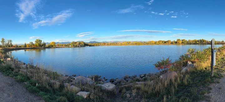
Try the 1.2-mile lake loop before exploring nearby streets. Waneka Lake Park combines a walking route, recreation areas and wildlife habitat. If a regular lake walk appeals to you, trace the actual connection from a home’s front door rather than judging access by distance on a map.
Plan a Waneka Lake visit ↗Coal Creek connections
For a different perspective, explore Lafayette’s connections to the Coal Creek Regional Trail. The City lists South Public Road and Flagg Park trailheads among its access points. Check the current trail map and closures, then try the route that would become part of your own week.
Explore Lafayette trails ↗