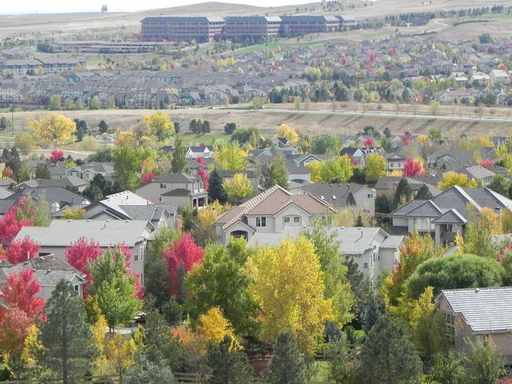
Superior neighborhoods
Open a neighborhood for a short local introduction and a link to find it on the map.
Calmante
Casalon Circle and Tierra Ridge Court lead into Calmante in southwestern Superior. The neighborhood has its own association, and its name appears on both Calmante Circle and Calmante Place.
Explore Calmante →Coal Creek Crossing
Follow Coal Creek Drive west from Original Town to find Coal Creek Crossing, just south of Sagamore. The town’s vicinity map makes the distinction between the neighborhoods clear at the lot level. It is a handy reference if you are comparing homes on opposite sides of the street grid.
Explore Coal Creek Crossing →Downtown Superior
Start on Main Street, where the Origin buildings place housing alongside Downtown Superior’s commercial streets. The architects designed the district around getting between homes, shops and civic spaces on foot. Walk a route you expect to repeat, then head back along a residential block to see how the public spaces meet the front doors.
Explore Downtown Superior →Lanterns at Rock Creek
Part of Rock Creek Ranch
Lanterns Lane leads into this named residential development within Rock Creek Ranch. The Town of Superior publishes a separate zoning summary for the community.
Explore Lanterns at Rock Creek →Montmere at Autrey Shores
Montmere’s townhomes line the south side of Autrey Reservoir. The reservoir paths and Lake Link Trail give a visit on foot a different perspective from the drive in. The metropolitan district publishes a governance guide that explains how the district and the townhome declaration share responsibility for the community.
Explore Montmere at Autrey Shores →Original Town
Around West Maple Street and Coal Creek Drive, Superior’s older street grid is easy to recognize on foot. Stop at Grasso Park to see the bungalow and outbuildings from an earlier farming operation. The blocks around the park offer a starting point for exploring how Original Town grew around the creek.
Explore Original Town →The Ridge at Superior
Rockview Circle and High Plains Drive help locate The Ridge at Superior in the western part of town. The town lists The Ridge separately in its neighborhood association directory.
Explore The Ridge at Superior →Rock Creek Ranch
Rock Creek Ranch stretches across Coalton Road, so two listings with the same neighborhood name can have quite different everyday routes. Try driving Rock Creek Parkway from each address. The master association’s calendar also offers a way to get to know the community through outdoor movies and seasonal gatherings.
Explore Rock Creek Ranch →Rogers Farm
Rogers Farm sits across McCaslin from Downtown Superior. The eastern part of the development is reached from the roundabout, with Coal Creek to the north and open space to the south. Approach from McCaslin first, then walk back toward the earlier homes to the west to see how the two phases fit together.
Explore Rogers Farm →Saddlebrooke at Rock Creek
Part of Rock Creek Ranch
Saddlebrooke is a condominium community in the Rock Creek area. Mallard Drive, Concord Lane and Eagle Avenue are useful streets to locate its residential buildings.
Explore Saddlebrooke at Rock Creek →Sagamore
Cherokee Avenue leads to Big Sagamore Park, a useful starting point for exploring this pocket of Superior west of the Marketplace. From the park, look for Shawnee Lane and the neighborhood’s short residential streets. Walk the actual turns to the shops before deciding how close a particular home feels.
Explore Sagamore →The Summit at Rock Creek
Part of Rock Creek Ranch
The Summit is a townhome community within Rock Creek Ranch. Look for the homes grouped along Rock Creek Circle around the shared 2855 street address.
Explore The Summit at Rock Creek →Map outlines are guides to exploration, not legal property boundaries. Available coverage and source notes appear on the map.
Three places to start exploring
Original Town
Start at Grasso Park, where preserved buildings connect Original Town to Superior’s agricultural history. Continue through the surrounding streets to understand the setting of each home. Look at the property’s age, condition and completed work individually; a historic area does not mean every home has the same story.
Explore Superior’s historic places ↗Rock Creek
Explore around Rock Creek Parkway and include a stop at Community Park on Coalton Road. Then test the paths and crossings you would actually use from a prospective home. The Town lists several associations in this part of Superior, so confirm the association and responsibilities attached to the specific address.
Find the relevant association ↗Downtown Superior
This newer mixed-use area brings homes, businesses and gathering places into one developing district. Walk the blocks that interest you and check which businesses are open today. Compare the home’s parking, outdoor space and immediate surroundings with the way you want to spend an ordinary weekday.
Explore Downtown Superior ↗