Broomfield neighborhoods
Open a neighborhood for a short local introduction and a link to find it on the map.
Anthem Highlands
Parkside Center Drive is a useful first stop in Anthem Highlands. The fitness center at number 3624 gives you a concrete destination for comparing the route from different streets. The community association handles recreation information for Anthem Highlands and Anthem Reserve, including facility access.
Explore Anthem Highlands →Arista
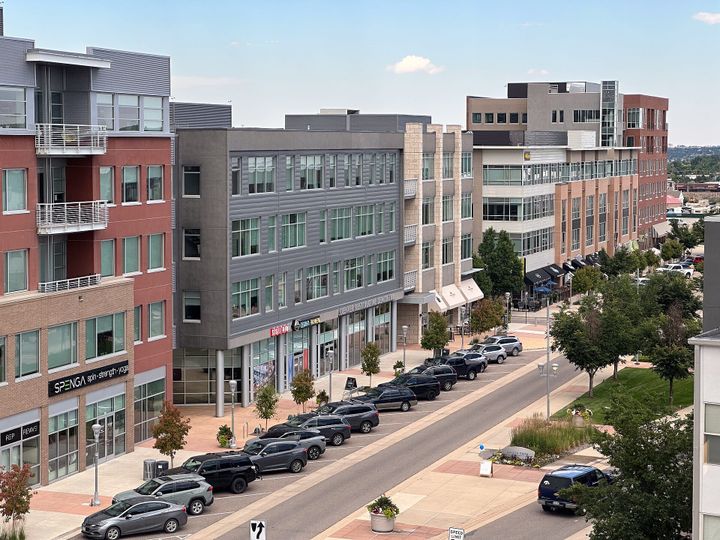
At Arista Place, a two-block pedestrian mall brings apartments, offices and restaurants around a central park. Walk the length of the main street, then try the route to the US 36 & Broomfield transit station. It is a useful way to see how the mixed-use district works on foot.
Explore Arista →Aspen Creek
Aspen Creek Drive gives visitors an easy starting point in this residential part of Broomfield. The Boulder Valley School District’s Aspen Creek PK–8 campus is a recognizable local landmark at 5500 Aspen Creek Drive.
Explore Aspen Creek →Brandywine
Brandywine Park is a practical first stop for exploring this neighborhood. Its public tennis courts appear in Broomfield’s recreation directory, where visitors can check court schedules before bringing a racquet.
Explore Brandywine →The Broadlands
Golf is one landmark in The Broadlands, but the development also links residential streets with parks, trails and a shopping center. Use the public course entrance on West 144th Avenue to get oriented, then follow the neighborhood route to whichever park or everyday stop you would actually use.
Explore The Broadlands →Broomfield Heights
Broomfield Heights grew after the Denver–Boulder Turnpike opened. In the streets known locally as the First Filing, ranch homes show the design choices available to early buyers. The city’s architectural survey also documents split-level houses in the Second Filing, making the two areas worth comparing on the same visit.
Explore Broomfield Heights →Columbine Meadows
Columbine Meadows Park has two distinct sides. Visit the east side for fields and trails or head west for the playground and benches. Hazel Street and Meadow Avenue are useful landmarks for finding the park from nearby residential streets.
Explore Columbine Meadows →Country Estates
Country Estates Park anchors this Broomfield neighborhood. The city lists a multipurpose court there, giving residents a nearby place for a game. Search using the full neighborhood name to distinguish these streets from Country Vista farther southeast.
Explore Country Estates →Country Vista
Country Vista Park sits on West 123rd Place east of Sheridan Boulevard. Its softball field, open grass and trails make a useful stop on a neighborhood visit, whether you are looking for an evening walk or a place to play.
Explore Country Vista →Crofton Park
Crofton Park and Columbine Meadows sit close together, but Broomfield identifies them as separate neighborhoods in its trail planning. Compare the two on the same outing, using the city’s parks plan to understand how local walking routes fit together.
Explore Crofton Park →Greenway Park
A nine-hole golf course is part of everyday geography in Greenway Park. The clubhouse on Greenway Drive makes an easy meeting point. The association publishes rates for residents and visitors who want to try the course.
Explore Greenway Park →Lac Amora
Josh’s Pond is a useful destination for exploring Lac Amora on foot. Start near Miramonte Boulevard and Oak Circle North, then follow the city’s mileage map west to the pond. The open space also connects to the regional trail network, so you can compare a short neighborhood loop with a longer outing.
Explore Lac Amora →McKay Landing
McKay Landing Parkway marks the residential community near McKay Lake. Use Zuni Street and West 138th Avenue to place the lake on the map when comparing homes and planning a visit to this part of north Broomfield.
Explore McKay Landing →Miramonte
A block north of Miramonte Boulevard, the park on Daphne Street has two halves linked by a path along the drainage ditch. The west side has a playground and basketball court, useful landmarks for a neighborhood walk.
Explore Miramonte →Northmoor Estates
Northmoor Park sits in the middle of this neighborhood at East 13th Avenue and Birch Street. Its soccer field and basketball and tennis courts make it a useful reference point for comparing homes on the surrounding streets.
Explore Northmoor Estates →Original Broomfield
On West 120th Avenue, the Crescent Grange and the old grain elevators mark Broomfield’s agricultural beginnings. The adopted neighborhood plan identifies those landmarks. On the smaller streets off 120th, the city’s historic survey documents a mix of housing, commercial buildings and older homes adapted for business.
Explore Original Broomfield →Westlake Village
West 134th Circle helps pinpoint Westlake Village in Broomfield property records. Westlake Middle School on West 135th Avenue is a nearby landmark for anyone finding their way around this part of town.
Explore Westlake Village →Wildgrass
Wildgrass Park offers a playground and basketball courts on the east side of Eagle River Loop and tennis courts on the west. For a closer look at the surrounding community, the Wildgrass Metropolitan District publishes both a district map and a master association map.
Explore Wildgrass →Willow Run
At Willow Run Parkway and Bryant Street, the neighborhood park opens onto a pond and trails leading south toward open space. The city’s regional trail map also shows a Big Dry Creek Trail connection at Willow Run Open Space. Walk the local approach first to see where to join the longer route.
Explore Willow Run →Map outlines are guides to exploration, not legal property boundaries. Available coverage and source notes appear on the map.
Three places to start exploring
Midway & its park connections
Start at Midway Park around Midway Boulevard and Kohl Street. Paths extend through other parks and cross several streets, making this a useful place to try an everyday walk. Notice the crossings and connections rather than assuming a nearby home has a direct route.
Explore Midway Park ↗Around County Commons
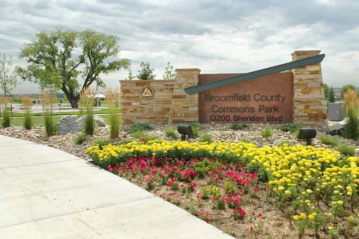
Explore the paths and recreation setting around Broomfield County Commons. The City identifies access from Lowell Boulevard near the Paul Derda Recreation Center and from Sheridan Boulevard. Visit when you would normally be out, then compare the approach from the streets and homes on your list.
Plan a Commons visit ↗McKay Lake surroundings
For a lakeside perspective, walk part of the trail around McKay Lake near 144th Avenue and Zuni Street. The lake is owned and managed by Westminster, beside Broomfield’s bike park. Check the current visitor information, then trace the connections from nearby homes and daily destinations.
Explore McKay Lake ↗