How Hard Is North Table Mountain in Golden?
Choose a North Table Mountain hike by the climb, trailhead and available time. See which trail has a seasonal closure and where to check conditions.
The mesa top can be deceiving
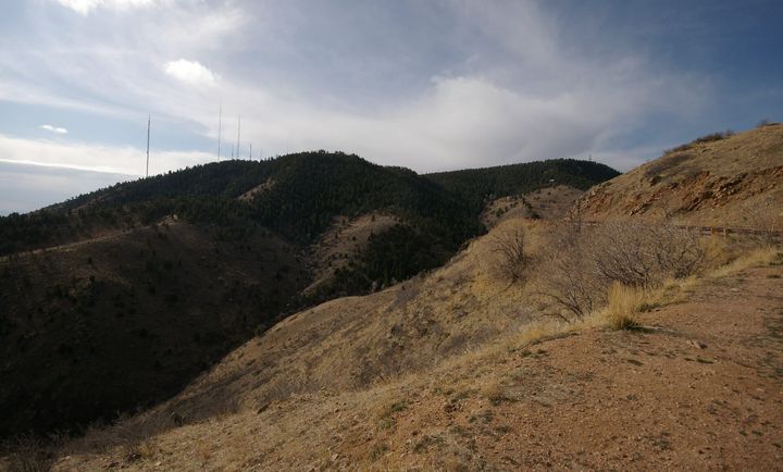
North Table Mountain looks flat from Golden because the top of the mesa is flat. Getting onto it is another matter. The approach from the west trailhead climbs steeply, so a short outing can still ask quite a bit of your legs. If you are choosing a first hike for visitors, ask whether they want a view of the mesa or a view from it. Those are two different afternoons.
Pick the right trailhead pin
The west trailhead is at 4788 Highway 93. Jefferson County also lists access on other sides, including the Golden Cliffs area. Save the county map and send your group the same entrance pin before leaving home. The words “North Table Mountain” alone can put members of the same party on opposite sides of the mesa. Mark your starting point on the map before choosing trails or arranging a pickup.
Choose a turnaround before choosing a loop
For a first visit, try the west approach as an out-and-back. Take a break partway up and turn around there if the grade feels like enough. If everyone feels good, carry on to the top and make a fresh decision with the map in hand. Much of the terrain is exposed. Carry water and a layer for wind, and remember that a steep descent can be slow going even after the hardest climbing is behind you.
Read the sign at Rim Rock
Rim Rock Trail has a recurring February 1 through July 31 wildlife closure. That name matters when somebody shares a saved loop that cuts across the top. Use the county’s current park alerts and map to choose an open alternative. After rain or snowmelt, look for temporary muddy-trail closures too. Planning the day around one named approach and a flexible turnaround makes it easier to enjoy the mesa even when a connector is closed.